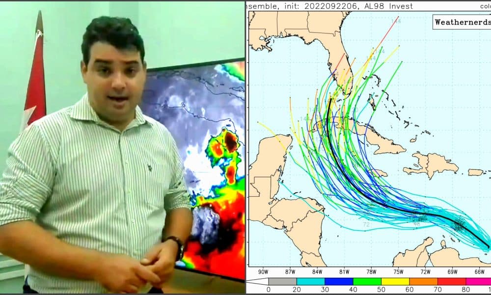
Well-known Cuban meteorologist Eller Bella shared with his followers on cable Some interesting details about the track cone and prediction models of the hurricane system. This explanation is very useful for understanding some aspects of the current season’s Tropical Depression 9, which could become a tropical cyclone with a possible path over Cuba.
Below we share the text posted by the specialist:
What happens to the cone? How is it built?
The cone is revised information provided by specialists, in this case the National Hurricane Center, that contains the forecast for that center and constitutes an official forecast.
It is based on a central path on which the cone is built. The error 2/3 in the forecasts of the past 5 years is taken as a basis, for each of the terms: 12, 24, 48 hours, as well as up to 5 days (120 hours). With this error, an imaginary circle is drawn centered around the expected point and the edges of that circle are joined to the shape of the cone.
But here is an important detail, we are talking about circles, circumference means that there is a certain error with respect to that central point, but not only “sideways” but also forward or backward in the path. Usually people do not see these details, because these imaginary circles do not appear and only the outer edge of the cone is visible. This error takes into account the delay or progress that there may be in relation to the forecast and this is also important.
cone and open it
The cone does not indicate true uncertainty in the prediction, the opening of the cone will always be the same as it depends on a constant error. It is also important, especially in the initial stages, where the cone is small, that people pay attention only to whether the center (what is expected) will pass through their area of interest. Even in a perfect forecast, dangerous wind, sea and rain phenomena will occur outside the cone, even in regions very far from the center of rotation.
And here is the importance of knowing something about these graphics because they will become more visible and popular, especially when there are dangerous situations.
It is good to get acquainted with them, because although they appear in official information and are explained by media professionals, very often they are shared by people who are not specialists or do not know them fully, and any user can go to consult this individual information.
And in each of these cases, it pays to get a better idea of what they’re seeing. Always remind them that any decision made on this type of information should always be based on official information and not on any kind of typical prediction.
Other examples of group-type models. The path in black is the average, not the most likely or safe.

“Beeraholic. Friend of animals everywhere. Evil web scholar. Zombie maven.”

:quality(85)/cloudfront-us-east-1.images.arcpublishing.com/infobae/5ST4G5IH4BHVJBR23UJOYCGW3U.jpg)


:quality(85)/cloudfront-us-east-1.images.arcpublishing.com/infobae/OHUU3SRVDNFCZLK6A2T3DG2C2M.jpg)

More Stories
This will be your health plan to prevent heat hazards
Mysterious creatures are swimming off the coast of the United States due to climate change, so what are they?
There is a place where time seems to pass more slowly.